Posts

Showing posts from December, 2025

Rethinking Urban Design

Image
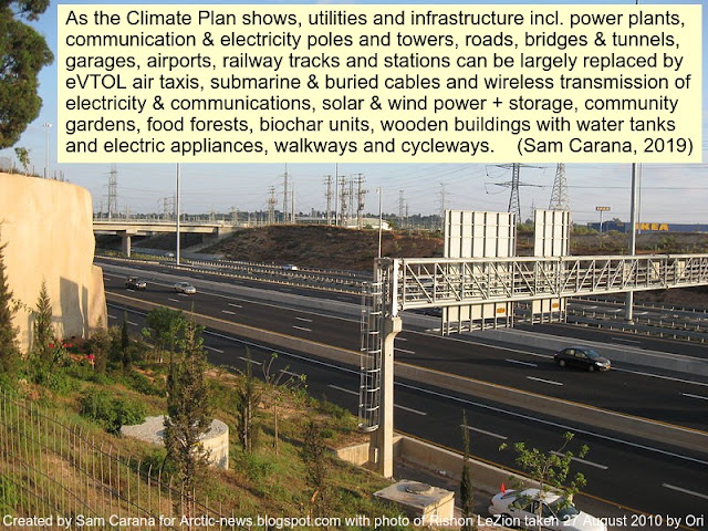
[ image from a 2019 analysis ] As temperatures rise, more extreme weather can be expected, resulting in stronger heatwaves, storms, flooding and forest fires. Cities are particularly vulnerable, due to the urban heat effect and since most cities are located at places prone to flooding. This makes it imperative to rethink town planning and urban design. Such redesign should include the location for buildings and traffic infrastructure such as roads and railways, bridges, tunnels, streetlights and traffic lights. This should also include infrastructure for essential services such as poles, masts and pylons carrying electricity and communications, sewerage works, stormwater drains, pipelines that carry water supply, fossil fuel, etc. Furthermore, much of the electricity used by cities is currently generated by coal-and-gas-fired power plants and by nuclear power plants that are vulnerable to extreme weather and that depend on stable supply of water for cooling. Such facilities shou...

Rethinking Infrastructure

Image
Rethinking Infrastructure The Climate Plan shows how to largely replace utilities and infrastructure such as communication & electricity poles & towers, and roads, railways, garages, bridges, tunnels, airports, by wireless transmission of electricity and communications, electric heating, eVTOL air taxis, wooden buildings with water tanks, rooftop solar and local storage, walkways & cycleways, parks, food from community gardens and food forests, and biochar units. [ image from earlier post ] As temperatures rise, more extreme weather can be expected, resulting in stronger heatwaves, storms, flooding and forest fires. Cities are particularly vulnerable, due to the urban heat effect and since most cities are located at places prone to flooding. This makes it imperative to rethink town planning and urban design. Such redesign should include the location for buildings and traffic infrastructure such as roads and railways, bridges, tunnels, streetlights and traffic lights. This...

High Altitude Platform Solar Plane

Image
[ US Air Force image, from Wikipedia ] The alpha version of the High Altitude Platform (HAP) Solar Plane is planned to  fly at 20,135 m (20 km) or 12 mile in the lower stratosphere, where there is a lack of wind and storm conditions. This is an altitude much lower than where satellites are typically located and this relatively low altitude results in less delay in communications (latency), enabling mobile phone connections virtually without delay, while also reaching locations not covered well or at all by mobile phone towers. This relatively low altitude also enables higher resolution images from cameras, radar and other sensors that allow it to see through clouds, making it ideal for monitoring weather conditions, imaging, security, emergency signalling, communications, navigation and positioning, live maps, accident and disaster monitoring, warning and response, and more. While land-based monitoring and surveillance systems can get affected by earthquakes, volcano eruptions, ts...